  • Temperature:23 ℃
  • PoP:60%

Mt. Bilu - Mt. Yangtou Traverse

Closed
  • Last Updated:2024-03-24
  • Browsing people:2976
  • Mt. Bilu & Mt. Yangtou Walking
  • A view of  Mt. Yangtou
Information
ManagementMt. Hehuan Service Station
Trail LevelGrade 4
Permits RequiredPark Entry Permit Required
Altitude3371Meter
The length of the trail0Meter
Needed time 2-3 days (thru-trek)
Remark1. Numerous landslides have previously occurred on the 820 Forestry Road. Please be careful when crossing these areas.
2. The trail markedly ascends in elevation past the Mt. Bilu trail entrance at the end of the 820 Forestry Road. Ropes have been installed at the steeper sections to assist hikers.
3. Hikers will need to carry at least 2 liters of water for cooking (dinner and breakfast) and hiking (~12 hours total). The water source on the ridgeline is difficult to reach.
4. The original route to Mt. Yangtou (along the river valley) is precipitous due to steep cliffs on its east side, causing landslides and rockfall during periods of heavy rain and numerous casualties. Considering these reasons, the trail has been rerouted in 2004 to the current route from Ci’en to the ridgeline junction.
5. Please take care to not lose your way through the bamboo forest.
6. Hikers do not need a Mountain Access Permit for the trail (within Ren'ai Township, Nantou County): this policy is as of February 2020.
7. Due to the landslide at the entrance of 820 Forestry Road, the entrance to the 820 Forest Road substitute route is located at Dayuling (the stairs next to Dayuling parking lot).
AddressMAP
Phone Number04-25991195

Note: 

The Mt. Bilu Day Ascent and Bilu-Yangtou traverse trails' trailhead from 820 Forest Road reopened starting from 9 December, 2021

  1. Due to the landslide at the entrance of 820 Forestry Road, the Taroko N. P. HQ has already provided a higher substitute road. Hikers are advised follow the signs. Do not go across the original route collapsed section of 820 Forest Road for your safety. 
  2. The entrances and exits of the substitute roads of 820 Forest Road on the higher section are explained as follows. There are relevant guided signs No. 1-25 along the way to Bilu Mountain. All hikers are advised to follow the directions signs. 

           A: The stairs next to Dayuling parking lot (intersection of the Provincial Highway 8 and 14A) go up.

           B: The wooden ladder is located at 0.3 kilometers along the 820 Forest Road.

Trail introduction
The Bilu-Yangtou traverse usually begins at the entrance to the 820 Forest Road, adjacent to the north exit of the Mt. Hehuan Tunnel at Dayuling. This route will travel eastwards from Mt. Bilu to Mt. Yangtou, and descends roughly 700 m over the course of the traverse. Hikers can also choose to start at the 132.4 km marker of Provincial Highway 8 and travel westwards towards Dayuling; however, due to more stringent constraints on water sources, distances to available campgrounds, and overall hiking time, most hikers will prefer an eastward route. At the Bilu river on the 820 Forest Road, which is the last and only available water source en route, hikers should refill at least 2 liters of water for cooking and hiking to last the remaining portion of the traverse.

羊頭山一景
The combination of a heavy pack (food plus tents), 2+ liters of water, and steep terrain for the majority of the traverse will test a true hiker's endurance. Many hikers choose this route to relish the great wilderness. Upon reaching the ridgeline, hikers have the opportunity to put down their rucksacks and observe the panoramic view at the Mt. Bilu triangulation point adjacent to the trail. A campground is located five minutes past the junction.
 

Geology and Ecology
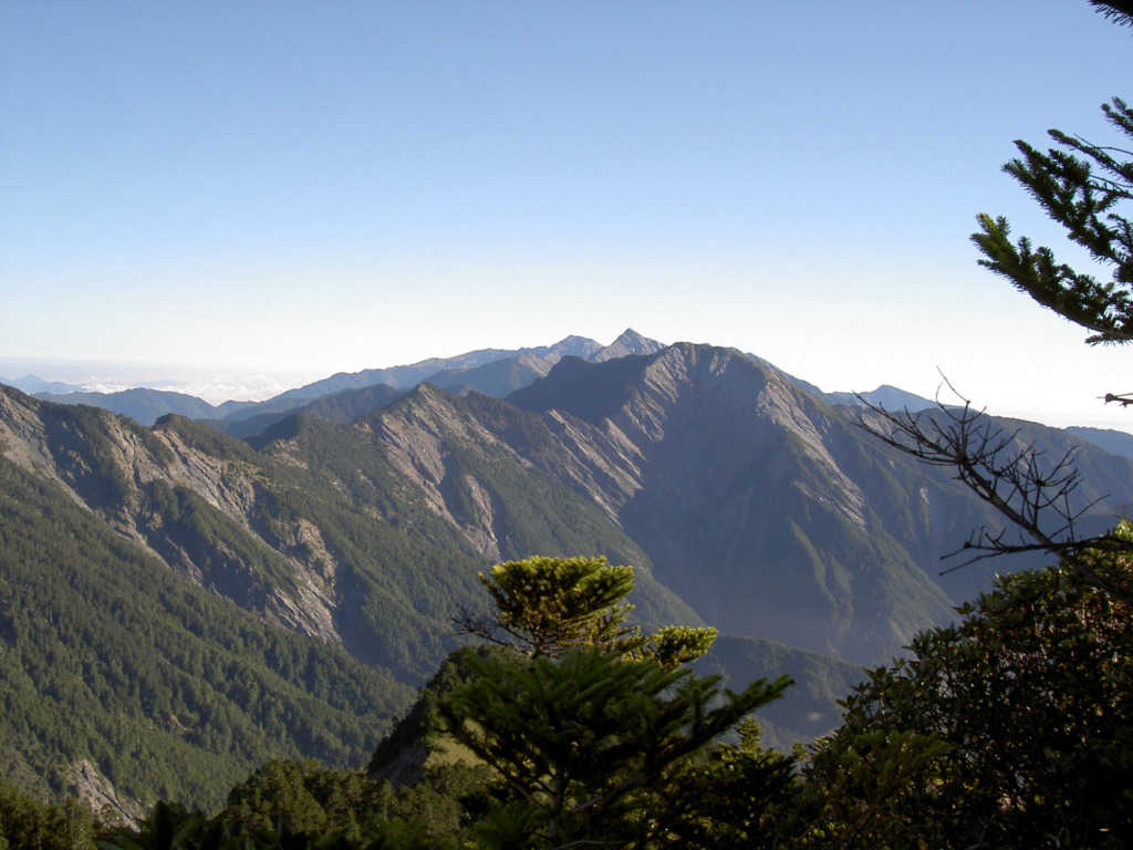
Mt. Bilu: 3371 m (elevation); #39 in the Taiwan baiyue (a list of Taiwan's 100 most spectacular mountains)
Mt. Yangtou: 3035 m (elevation); #98 in the Taiwan baiyue. Mt. Yangtou gets its namesake ("sheep's head") from the shape of the mountain, which resembles a sheep's head.
Mt. Ju: a series of 7 peaks stretching across 2 kilometers, with the highest peak at 3276 m elevation. As its name suggests, the series of peaks resembles a sawtooth. Mt. Ju is one of the "9 cliffs" of Taiwan's mountains. Its forests are primarily comprised of Taiwan fir (Abies kawakamii), with Yushan bamboo (Yushania niitakayamensis) interspersed among the trees.
 

Resources

Service Facitilies
Mountaineering.
Traffic Information
Bus1. From Hualien Station, take a bus bound for Lishan-1141 (served one bus daily) and alight at Dayuling Stop.
2. From the west entrance: The entrance to the substitute route of 820 Forestry Road is at Dayuling bus stop, which is serviced by Hualien Bus 1141.
3. Bus schedules are available from #iBus Info System, and please check Route Search> Search by Bus Operator> Hualien Bus 1141
3. Please consult News > FAQ on our website. “Transportation: Where can I purchase day passes for buses to Taroko National Park?.” and “Transportation: How can I reach Mt. Hehuan from Hualien?”
DrivingFrom the west entrance:
- From Hualien and Taroko: Travel westwards along the Central Cross-Island Highway (Provincial Highway 8). Continue along Highway 8 and reach Dayuling. Due to the landslide at the entrance to the 820 Forest Road, the entrance of the 820 Forest Road substitute route is the stairs next to Dayuling parking lot.
- From Puli, Nantou (Sun Moon Lake): Travel eastwards along Provincial Highway 14 and connect towards Provincial Highway 14A (14Jia) upon reaching Ren’ai Township. When you reach the end of the highway at Dayuling, the entrance to the 820 Forest Road substitute route is located at Dayuling (the stairs next to Dayuling parking lot).
From the east entrance:
The trail entrance of Mt. Yangtou is situated before the Ming Tunnel (Rockfall Protection Tunnel) at the 132.4 km marker of the Central Cross-Island Highway (Provincial Highway 8).