Note: The Shakadang Trail extends beyond the Xiaozhuilu Trail below the Shakadang Bridge.
Trail Introduction
Xiaozhuilu ("Little Zhuilu") Trail is on the slope next to the lower reaches of the Liwu River outside Shakadang Tunnel. Xiaozhuilu Trail was built by Taroko National Park Headquarters. Taking Xiaozhuilu Trail from Taroko Terrace, the entrance to Xiaozhuilu Trail can be directly reached and then Shakadang Trail walked on. The entrance to Xiaozhuilu Trail is on the left of the Shakadang Tunnel's east entrance; setting off from Taroko National Park Headquarters Visitor Center (Taroko Terrace), enter the left outside of the Shakadang Tunnel and walk along the steep (with stairways) terrain for about 450 meter. The East section 450 meter, east to west one-way traffic only, the terrain is rather steep. The elderly and children with poor physical fitness should avoid entering. After about 450 meters, the eastern ventilation opening of the Shakadang tunnel will be reached; the west section (450-1050 m) trail is connected.
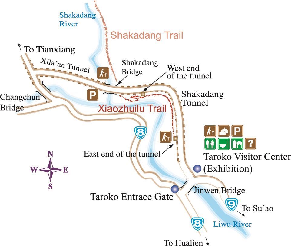
Xiaozhuilu Trail Map
Scenery and ecology
Entering the second section trail, a wooden plank path winds along the steep slope beside the Liwu River. To the east there are cliffs. On one side of the trail is the Liwu River gorge, on the other the forest growing on the steep cliff. The trail passes through dense trees; in a few places not covered by trees, the wide river bed of the lower reaches of the Liwu River can be seen, as can the arch gate that marks the start of the Central Cross-Island Highway and Jinwen Bridge that spans the Liwu River.
Scenery and ecology
On the middle of section of the trail there is a suspension bridge over a dry creek ditch. Not long after crossing this bridge, the trail flattens out and then the west ventilation opening of Shakadang Tunnel is reached. Outside the ventilation opening the ground is flat and Taiwan zelkova (Zelkova serrata), Subcostate Crape Myrtle (Lagerstoemia subcostata Koehne), Griffith’s Ash (Fraxinus formosana Hayata) and Odourbark Cinnamomum (Cinnamomum insularimontanum Hay) grow, making it a good shaded place to rest awhile. Going west from the ventilation opening, the trail widens and zigzags down, reaching a point below Shakadang Bridge, joining Shakadang Trail.
From the eastern entrance of Xiaozhuilu Trail cliff terrain that resembles Zhuilu Cliff can be seen, which is why Xiaozhuilu (Little Zhuilu) was so named. From the trail, the beautiful river gorge of the lower reaches of the Liwu River can be viewed. The vegetation along the trail is also well worth observing. As Shakadang Trail has limited parking spaces, walking from Taroko Terrace along Xiaozhuilu Trail to Shakadang Trail not only offers an additional opportunity to get close to nature, it also reduces the difficulty of finding a parking space.
Travel focal points
First stop: Xiaozhuilu Cliff
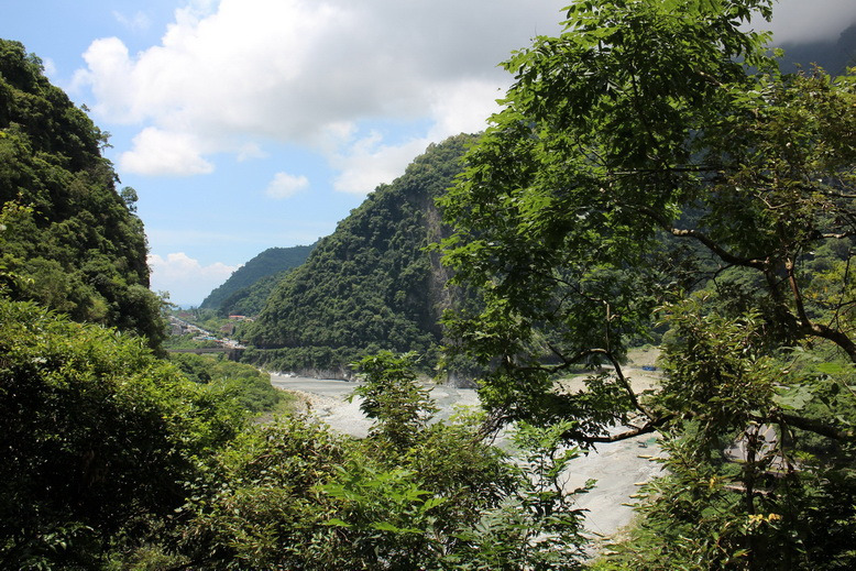
As soon as the trail starts, on the left side there is a towering marble cliff, this is the sheer Xiaozhuilu Cliff. Looking to the east, the arch marking the start of the Central Cross-Island Highway can clearly be seen, as can Jinwen Bridge spanning the Liwu River.
Xiaozhuilu Cliff
Second stop: Little suspension bridge
The wooden plank path is built along the slope on the north bank of the Liwu River, steps climbing up through dense broadleaf forest. Before too long there is a little suspension bridge over a dry creek ditch that is fun to cross.
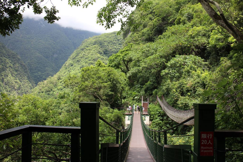
Little suspension bridge
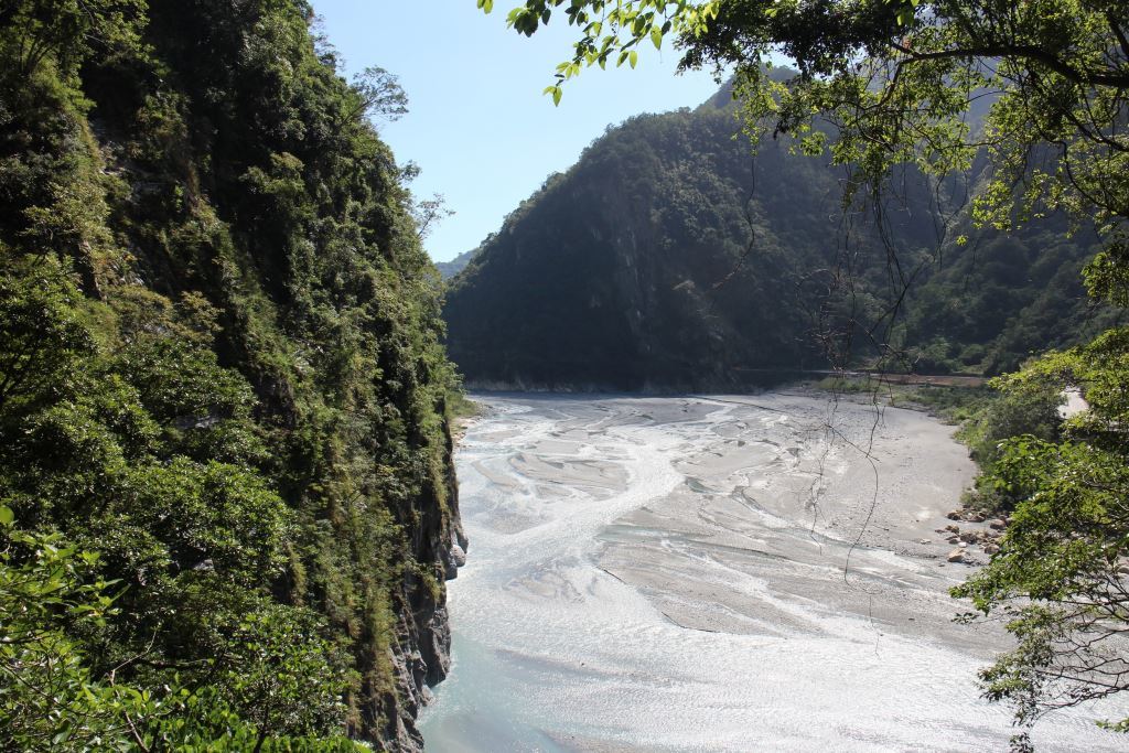
Third stop: Viewing platform
A short distance after crossing the little suspension bridge, where the land flattens out, there is a viewing platform that offers views out over the winding lower reaches of the Liwu River and Taroko entrance. At the side of the viewing platform is the west ventilation opening of Shakadang Tunnel. Outside the ventilation opening is a flat terrace on which Taiwan zelkova, Subcostate Crape Myrtle, Griffith's Ash and Odourbark Cinnamomum grow, offering shade if you want to take a rest.
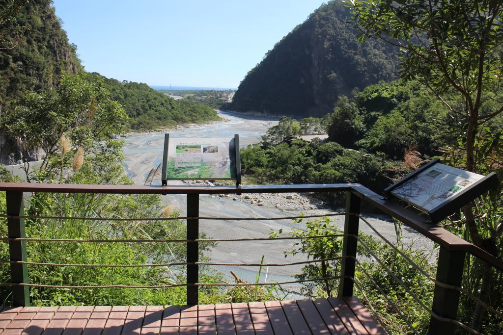
Viewing platform
Fourth stop: Entrance to Shakadang Trail
Continuing on from the viewing platform, the trail is wide and lined by dense forest. After a few turns, the entrance to Shakadang Trail is reached; from here, Shakadang Trail can be explored or you can go up the steps and return to the highway. 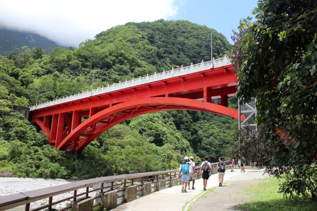
Entrance to Shakadang Trail