Note: The Mt. Qingshui Trail extends beyond the Dali-Datong Trail.
Trail Introduction
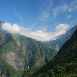
Mt. Qingshui, at an elevation of 2,408 m, is located on Taiwan's East Coast in Xiulin Township, Hualien County. With Mt. Sanjiaozhui and Mt. Ta , the three mountains are collectively known as the three Taroko mountains. From Mt. Qingshui, steep rock cliffs slope eastwards from the summit all the way to the Pacific Coast, creating the famous Qingshui Cliff. The Shakadang river separates Mt. Qingshui from Mt. Sanjiaozhui towards the west; lastly, the Hualien plains and the Coastal mountains lie southwards. The summit of Mt. Qingshui commands an impressive 360 degree view that encompasses not only Taiwan's beautiful Pacific coast, but also the Central Mountain Range that includes the Qilai East Ridge, the entire North Sections 1 and 2, Mt. Erzi, Mt. Sanjiaozhui, and Mt. Xiaoxing.
History
The trail has historical significance—part of the trail travels along a planked road.
Ecology
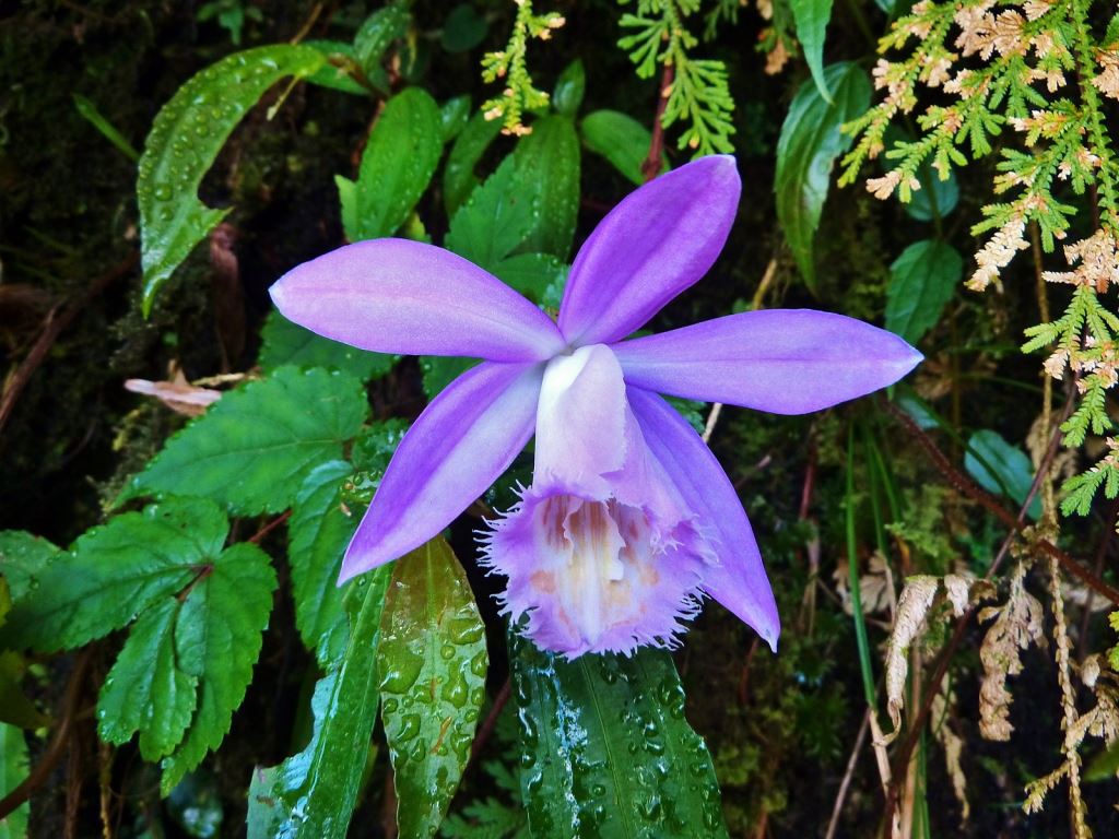
Mt. Qingshui is situated within the cloud belt of Taiwan's mountainous area; therefore, is subject to abundant rainfall and fog. As such, the ecology is rich and is optimum habitat for moss, lichens, and epiphytic plants. Mt. Qingshui lends its name to many endemic plants, such as the Qingshui juniper ( Juniperus chinensis var. tsukusiensis), Qingshui narberry (Berberis chingshuiensis), Qingshui aster ( Aster chingshuiensis), Qingshui privet ( Ligustrum seisuiense), Qingshui photinia ( Pourthiaea villosa var. chingshuiensis), and Qingshui hyperium ( Hypericum nakamurae). In addition, a wide variety of slipper orchids thrive in the wet environment. Grasshoppers are particularly active after rainfall, and is a major feature within Mt. Qingshui's fauna.
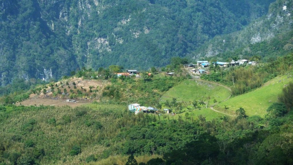
Stop 1: Dali Village ( Xoxos)
Referred to as "Xoxos" by the indigenous Truku Tribe, at 915 m a.s.l., Dali Village can be divided into an upper and a lower section, where the upper section was situated above the original local Dali police station. In 1979, residents relocated to the foot of the mountain; however, some members often return to Dali to farm the land.
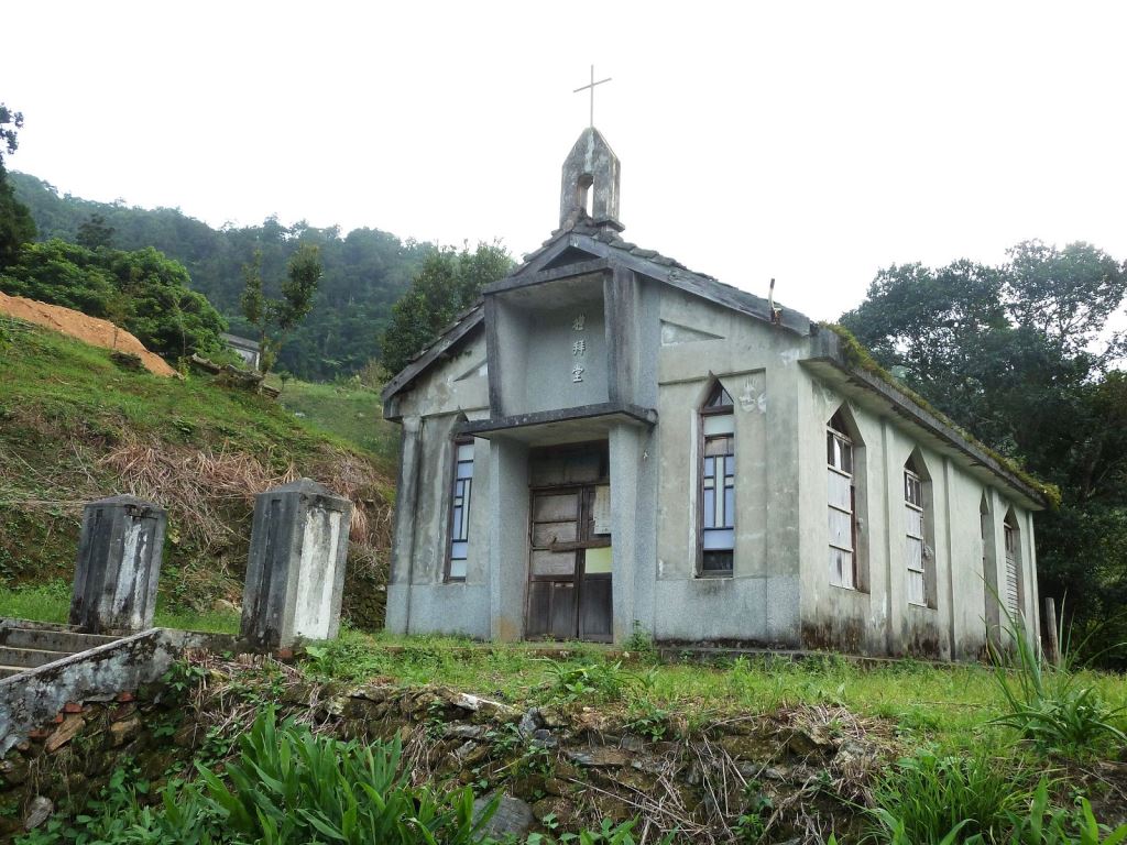
A primary school was built in the village in its early days; today the building still stands, though is currently used as a chicken house. Dali still holds a number of residents, who are mainly farmers growing crops such as corn, cabbage, green beans, and green peppers. Even today, their houses are still modeled on the original designs from previous generations, constructed using bamboo and wood to construct simple, yet sturdy and durable accommodation.
Stop 2: Datong Village (Skadang)
Located on an upland plateau 1,128 m above sea level, Datong is located above the left bank of the middle reaches of the Shakadang river. For the Truku tribe, Datong is called "Skadang", which translates to "molar teeth". During the Japanese Colonial Era, a local outpost was stationed in the village to oversee rule over the Truku tribe living in the area, which was abolished after retrocession in 1945.
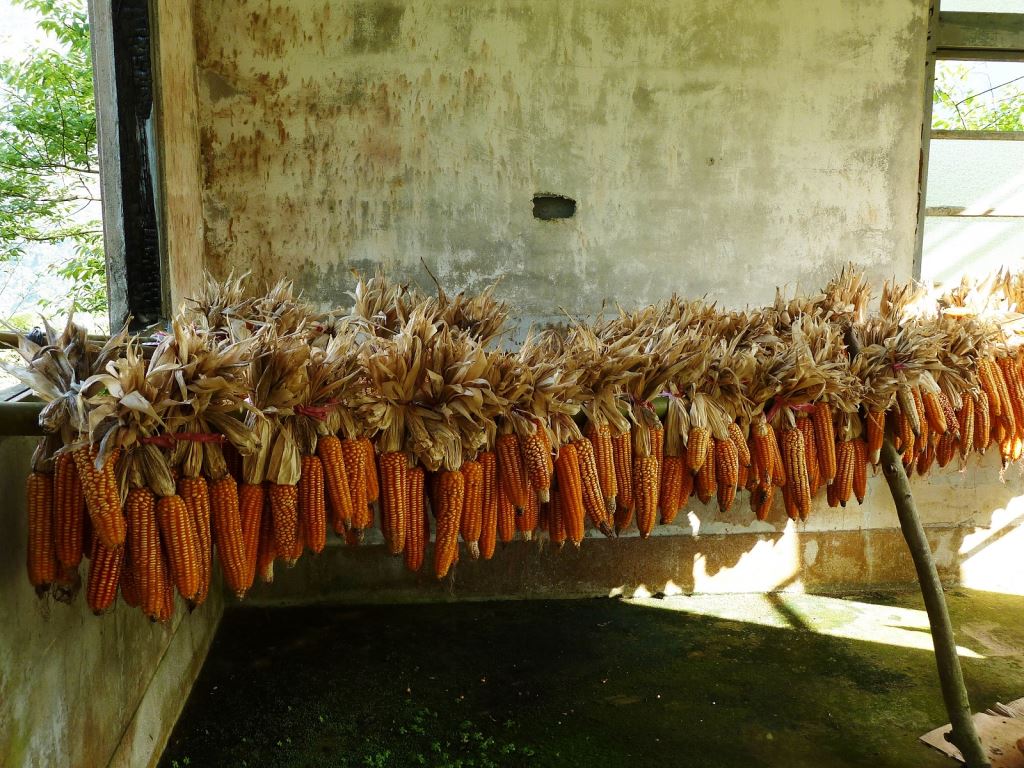
Agriculture currently is the predominant industry in Datong, where residents grow corn, green peppers, cabbage, green beans, persimmons, snow lotus, among other crops. In recent years, residents in combination with the residents of Dali Village established the "Dali-Datong ('Tongli') Village Natural Ecology Autonomous Association" to live harmoniously with nature and the surrounding environment, whilst simultaneously providing a representative voice in local politics.
Resources