Note:
The shrine to Bell Tower section of the trail is at high risk of rockfall and is closed for safety reasons.
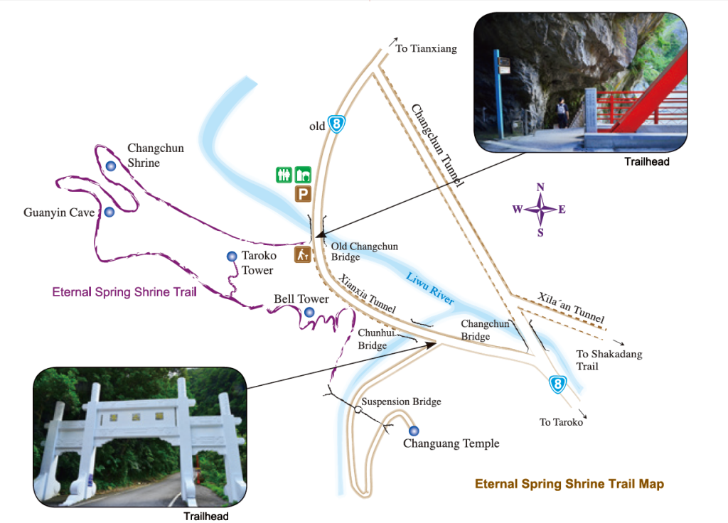
North section: Changchun Bridge-Shrine 0.3 km/one way/20 minutes a round trip
South Section: Changuang Temple-Bell Tower 0.4 km/one way/40 minutes a round trip
*Please return by the same route (double back).
Trail Introduction
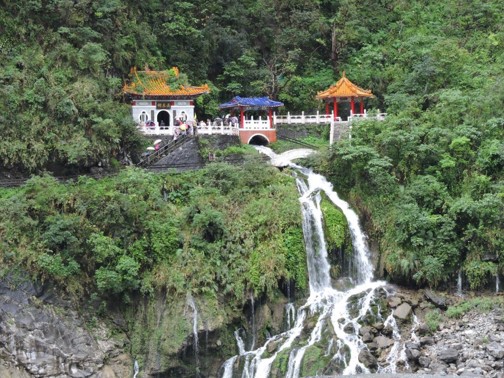
The Eternal Spring Shrine was built to honor the workers that died while building the Central Cross-Island Highway. The Changchun Shrine Trail (Eternal Spring Shrine Trail) begins with a descending stairway at the end of the Old Changchun bridge. The narrow trail goes through short tunnels hugs along cliffs over the Liwu River. The actual Eternal Spring Shrine is only 300 meters from the trailhead and relatively easy short walk.
From the shrine, the trail zigzags up the mountain resulting in a sharp vertical rise within a short space. There are steps all along the way even though it is not a terribly difficult trail, it has its moments and has become known to some as the “Stairway to Heaven”.
Following this celestial stairway you will pass through the Kuanyin Caves and will then get to a point where you have a birds-eye view of the Taroko Entrance Arch Gate and the Bell Tower. From the Bell Tower the view is even better, as you can see the Liwu River snaking its way through the last bits of the gorge before its opens up to the delta and the Pacific Ocean. You can also watch the cars and people are so tiny far below.
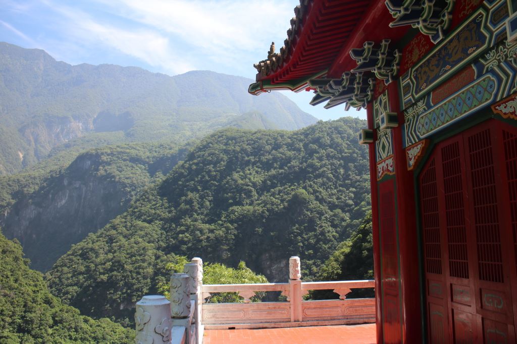
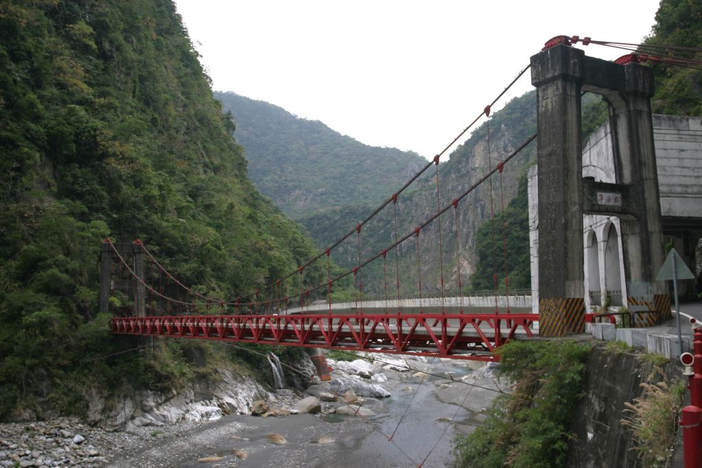
The Bell Tower is the highest point on this trail. So, you will begin your descent here, going through a shaded forest in what is likely to be the most relaxing part of the hike. Before long you will arrive at a suspension bridge leading to the front entrance of Changuang Temple. Unless you want to visit the temple, turn to right after crossing the bridge and follow the road down to the Changuang Temple Gate which is right on the old Central Cross-Island Highway. From there go to your left, and within a couple of minutes and after passing through a short tunnel you will arrive back at the trailhead. You can either start hiking this trail from Changchun Shrine or Changuang Temple. You could choose to start the trail from Changuang Temple heading to Changchun Shrine (Eternal Spring Shrine), and this would make the hike much easier.
It is about a twenty-minute walk from the Changuang Temple (Zen monastery) to the Bell Tower (the highest point on the trail). Walk another five minutes to Taroko Tower and then on to the Guanyin Cave, the Eternal Spring Shrine, and the Changchun Bridge. The total distance is about 2 kilometers. The entire trail takes about an hour to 1.5 hours.
History
The Eternal Spring Shrine was built by the Directorate General of Highways in 1958 during the construction of Provincial Highway 8. The shrine was built to commemorate a total of 226 men lost their lives and 702 were injured working on the highway. The road was built to address national defense and national economic needs. The name of all those who were killed also can be viewed in the Changchun Shrine. The highway is actually a network of roads comprised of the main trunk from Taroko Entrance Gate to Dongshi, Taichung (185km)(Provincial Highway 8), a branch from Lishan to Luodong (Provincial Highway 7A (7 jia), and an artery running between Dayuling and Wushe (Provincial Highway 14 A (14 Jia). Work on the project commenced July 7, 1956 and took 5,000 to 6,000 men working every day for more than three years and nine months and 19 days to complete. The official opening date was May 19, 1960.
During Typhoon Herbert in August 1979, landslides to the west of this area caused boulders to crash down on the shrine and other nearby structures. The reconstruction was completed on 17 March 1980 but the shrine was once again destroyed by landslides on 6 July 1987. Thus, the shrine you see before you is the third incarnation of the Eternal Spring Shrine!
Geology, Meanders, and Natural Springs
Interlocking layers of marble and Calcic Quartz Schist distinguish the geology of this area and also lead to a rather unstable environment in terms of landslides. This is exacerbated by the river’s natural but relentless rush to the ocean. The original buildings collapsed after a typhoon in 1979 and were rebuilt on an even greater scale three years later only to be claimed by nature again in 1987. In the last round of rebuilding, the structures were placed to the left of its original location to avoid the fault lines.
From the Eternal Spring Shrine continue up the mountain to the steep cliffs high above the Liwu River. High in the clouds you will have great views of the river as it winds its way through the marble gorge down to the Pacific Ocean. The trail provides a good setting to contemplate the building of this road and the lives that were sacrificed.
How are meanders formed ?
- When the river comes up against relatively hard rock it naturally seeks softer areas, and this means the river will carve out the less dense rock resulting in the curved shapes in the river bed that you can see in this part of the gorge.
- The river water etches away at the rock along the sides causing large stones to tumble into the river.
- As the banks are cut away the riverbed is widened.
Natural Springs
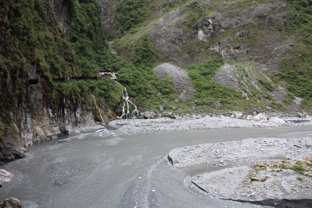
The waterfalls originating from cracks and crevices in the cliffs below the Changchun Shrine are springs and are also known as the Eternal Spring Flying Springs. Springs are formed when ground water rises through fissures in the rock beneath the surface. The spring water is comprised of water that has seeped from the surface into the ground over many many years. The cracks through which the springs emerge tend to become larger and larger as they wear away the rock. Beneath the surface of the Eternal Spring Shrine are two sources of spring water. Two other similar springs can be seen further up the road, one at the Ning’an Bridge and the other at the Jinheng Bridge.
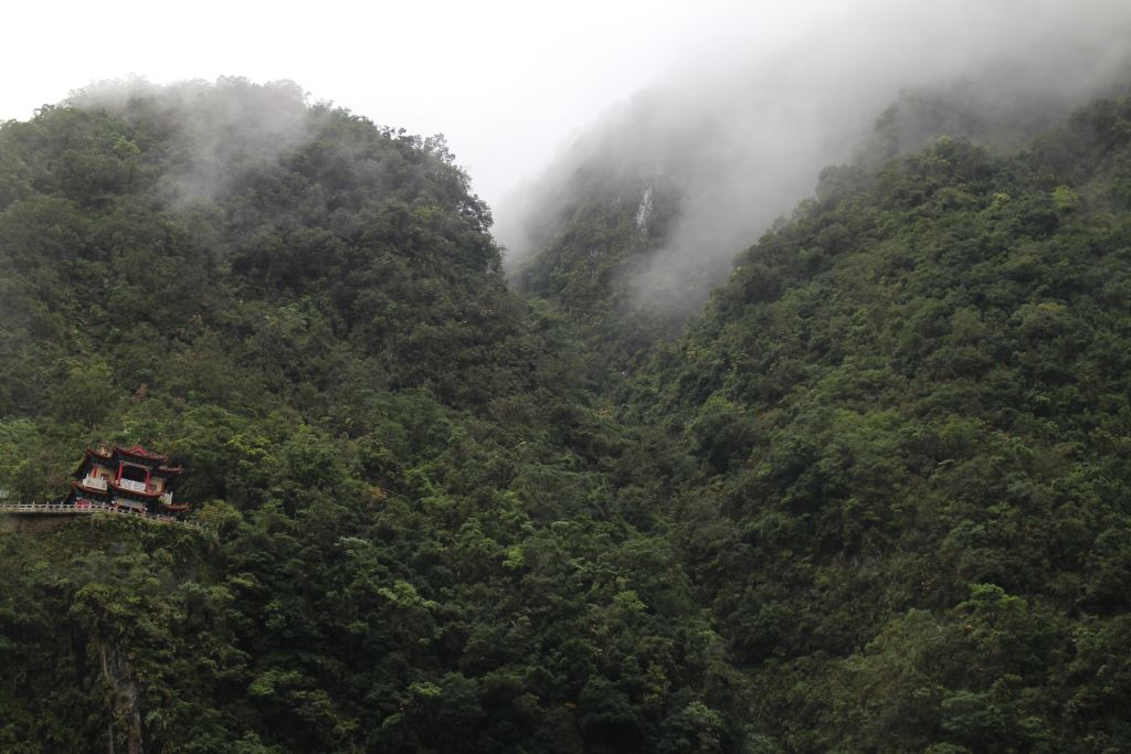 Taroko Tower
Taroko Tower and Bell Tower
From the shrine the trail zigzags up the mountain resulting in a sharp vertical rise within a short space. Passing through Taroko Tower, one can reach the highest point of this trail- Bell Tower. Overlooking from the Bell Tower, you will see the meander Liwu River, as well as Xila’an village and Dali village. The architecture of the buildings on this path follows the traditional Chinese style. The traditional Chinese style of Bell Tower and Taroko Tower were built by the Directorate General of Highways. The Taroko Tower was built to commemorate the late President Chiang Kai-Shek.
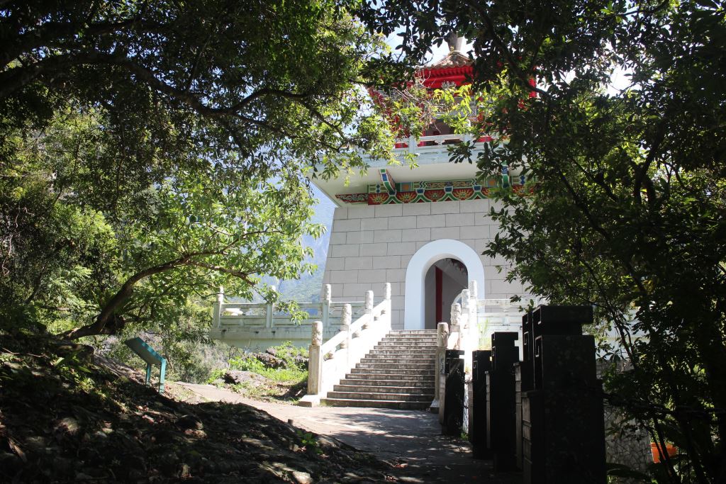 Bell Tower
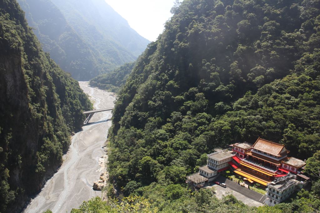 Overlooking from the Bell Tower to the Changuang Temple
Nearby Scenic Spots :
Ning’an Bridges
Heading west and not far from the Changchun Shrine are the old and new Ning’an Bridges running parallel one to another. The old Ning’an Bridge is a steel girded suspension bridge and was built just as the construction of the Central Cross-Island Highway was beginning. The old bridge was wide enough only for one vehicle at a time so since the new bridge was built the old bridge has just been for pedestrian traffic. The new bridges made of cement and with its opening to traffic in 1989 one can enjoy the comparison of the need and old civil engineering designs.
The God of Bodhisattva (Bu Dong Ming Wong)
There is a small temple located in a stone cave beneath the old Ning'an Bridge which is to pay homage to the god of Bodhisattva. Tradition has it that during the last years of Japan’s colonization of Taiwan, in order to get better access to the gold in the area, brought a bronze statute of Bodhisattva and established this as the god’s resting place so that the god would protect the workers and ensure that things went smoothly for them. The statute disappeared and in 1951 Taipower re-erected a statute and restored the temple. In addition to the god, the temple also houses a small, clear, and cold fresh water spring.
Due to the rockfall damages, the temple is closed. Please do not enter this restricted area.

Silver Ribbon Falls
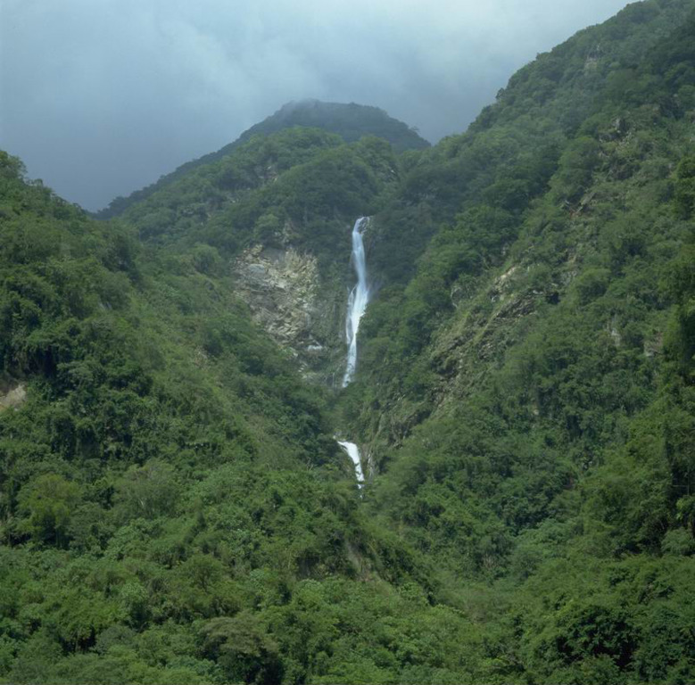
Not far from the west end of the Ning’an Bridge, and on the north side of the Liwu River, there is a two-stage waterfall cascading down from the mountain. It appears as a white band pasted to the side of the mountain and the falls are known in Chinese as the Yindai Falls, the “yin” meaning “silver” and “dai” meaning “ribbon” or “band”. The fall can be clearly seen from the Central Cross-Island Highway however the degree of visibility varies with the weather. When there has been a lot of rain, the water flow is quite high and the falls stand out more than during periods of drought when the falls are just a trickle and barely visible at all.
