Note: Qilai North Peaks and Qilai East Ridge: At the 5.7 km mark on the Mt. Qilai Trail, at the junction of the Qilai Main and North Peaks, hikers are only permitted to turn right toward the Qilai Main Peak. After reaching the main ridge, you may proceed to the Qilai Main Peak, North Peak, or East Ridge, starting January 3, 2025.
Note: The Mt. Qilai Trail extends beyond the Xiaoqilai Trail. The Qilai East Ridge Trail extends beyond the Mt. Qilai Trail at Mt. Qilai North Peak. The Nenggao Historic Trail connects to the Mt. Qilai Trail at Mt. Qilai South Peak Trailhead.
Trail Introduction
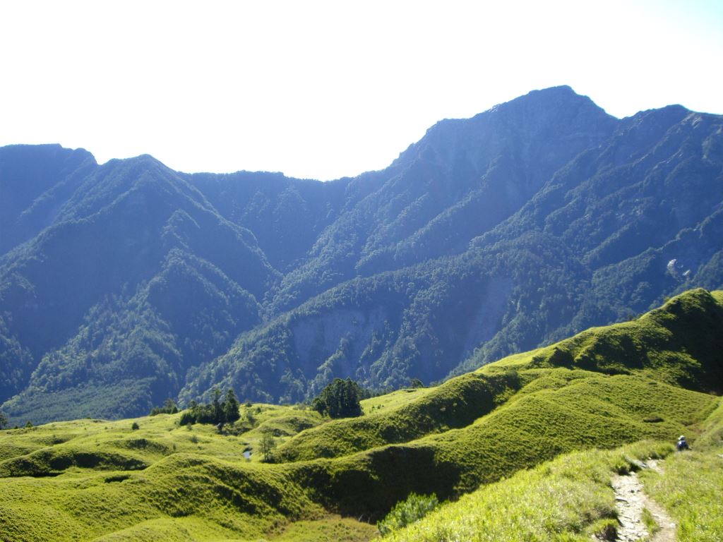
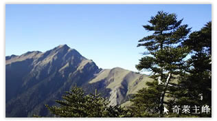
The Qilai mountain range can be divided into two sections: the Main and North Peaks of Mt. Qilai are located east of Mt. Hehuan, while the East Ridge distantly follows the trajectory of the Liwu Valley. Mt. Qilai's Main and North Peaks are not only included in the Baiyue (Taiwan's Top 100 Mountains), but Mt. Qilai North Peak is one of Taiwan's "10 Glories" that many mountaineers aspire to summit.
The Qilai Mountains can roughly be sectioned into three different itineraries that span various distances and difficulties.
1. Mt. Qilai Main/North Peaks: This trail itinerary is the most popular within the Qilai Area. If well-planned, the entire trail can be completed in two days, including summiting both the Main and North peaks of Mt. Qilai.
2. Mt. Qilai Series/Traverse: In addition to summiting the Mt. Qilai Main and North Peaks, this trail itinerary also passes the challenging Kaluolou Cliff to reach Mt. Qilai South Peak, another one of Taiwan's Baiyue. Mt. Qilai South Peak is popular among hikers, especially as part of the Nenggao Historic Trail . The section between Mt. Qilai South Peak and Tianchi Cabin is particularly affected by typhoons, and is often impassable due to the collapse of trail from high winds and heavy rain. Hikers should be especially careful when passing the Kaluolou Cliff, where weather conditions in this area change especially quickly and dramatically, with fog arising during the afternoon. The majority of the trail runs along this and other cliffs; hikers should be careful throughout the trail.
3. Qilai East Ridge: This route itinerary comprises at least 6 days, and is especially difficult due to the scarcity of reliable water sources along the second half of the route.
History
Mt. Qilai is also known locally as "Black Qilai" due to the high frequency of accidents and the largest number of accidental deaths in Taiwan occurring within the trail. In addition, the west face of Mt. Qilai, viewable only from the Mt. Hehuan area, only receives sunlight before noon and is shrouded in thick fog and mist in the afternoon, retaining a gloomy quality for the majority of the day. As such, the indigenous people living in the region both respected and feared the mountain.
Stop 1: Mt. Qilai North Peak
Standing at an elevation of 3,607 m, Mt. Qilai North Peak is a classic triangular-shaped mountain peak and is one of the Taiwan Baiyue's "10 Glories". Cliffs surround the peak on the North, West, and South faces, whereas prairies gently slope downwards along the east face. The prairies continue further eastwards towards Mt. Panshi and is composed of scattered rocks among short, green bamboo (Fargesia demissa) grassland, presenting an altogether completely different landscape compared to the rest of the Qilai area.
Stop 2: Mt. Qilai Main Peak
Mt. Qilai Main Peak, also a member of the Baiyue, sits at an elevation of 3,560 m. Like the North Peak, this peak is similarly precipitous: the ridge leading towards the North and South Peaks follow two separate cliffs. To its West lies yet another cliff composed of loose soil, while the trail towards the East descends rapidly towards a deep depression. The green bamboo (Fargesia demissa) grassland can be seen towards the Northeast, which, when illuminated with the first rays of sunrise, present an incredible and beautiful landscape.
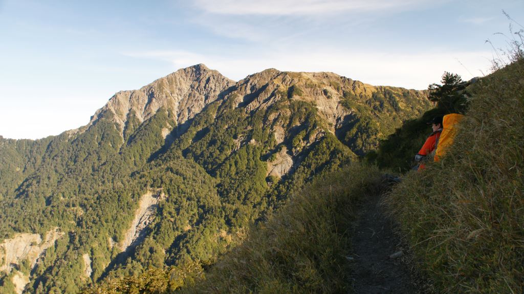
Upon passing the Main Peak, hikers traverse along the Kaluolou Cliff. Though a thrilling section to hike through, the ground is composed of slate which is inherently unstable.
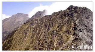
Stop 3: Mt. Kaluolou
Mt. Kaluolou, at an elevation of 3,385 m, presents the most challenging section of the Qilai mountain range due to the constant presence of high winds and low visibility from being situated within the cloud layer. A wide variety of flora can grows within the Kaluolou Ridge, including the Himalayan juniper (Juniperus squamata) and the gold-flower Yushan rhododendron (Rhododendron pseudochrysanthum).
Stop 4: Mt. Qilai South Peak
At 3,358 m, Mt. Qilai South Peak stands alone at the southern end of the Qilai Mountain Range. Short bamboo grass spans the entirety of the path leading from the South Peak trail entrance to the summit. Because of its relative isolation from the North and Main peaks, hikers often trek to Mt. Qilai South Peak from Tianchi Cabin from the south as part of the Nenggao Historic Trail, which starts and ends at Tunyuan.

Resources