Trail Introduction
Mt. Nanhu and its associated peaks area collectively located in the northwest area of Taroko National Park and therefore under the jurisdiction of the Park Headquarters. Because Mt. Nanhu lies within the Ecological Protection Area, hikers are required to apply for a Park Access Permit and a Mountain Access Permit prior to entering this trail.
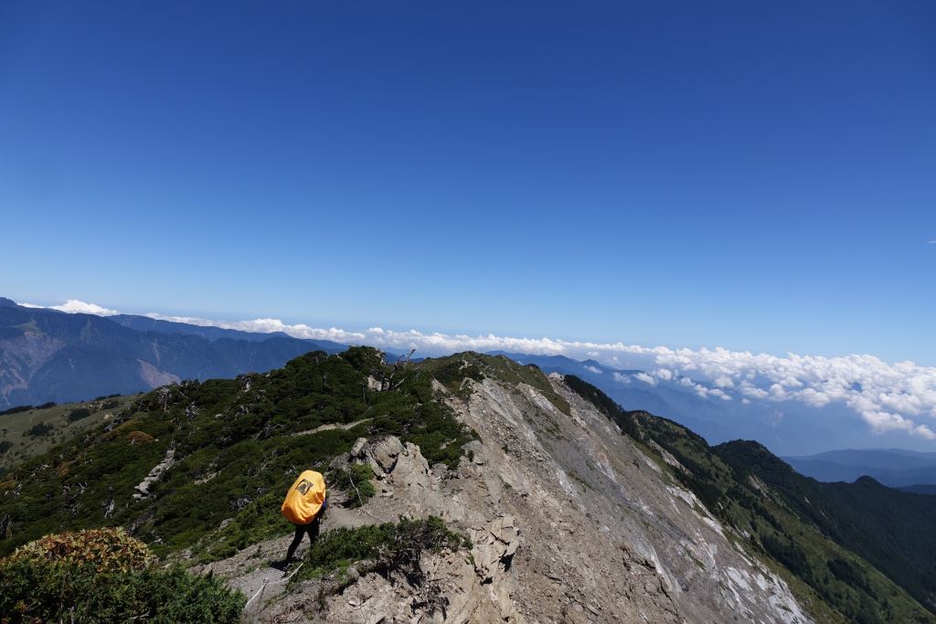
Mt. Nanhu sits at the northern edge of the Central Mountain Range and is one of the Baiyue's (Taiwan's Top 100 Peaks) "Big Five" (the other four being Jade Mountain, Snow Mountain, Mt. Xiuguluan, and Mt. Beidawu). Mt. Zhongyangjian, which borders Mt. Nanhu immediately to the south and is considered within the same domain, is one of the Baiyue's "Pointy Three" (the other two being Mt. Dabajian and Mt. Dafenjian). During winter, the Nanhu Mountains often experiences significant snowfall which increases the difficulty of the route. Those who wish to enter this area in the snow season should be especially careful and have adequate winter mountaineering experience.
If a typhoon or heavy rain is forecasted during your prospective hiking dates, please abide by the restrictions announced by the Park Headquarters during this time. Hikers who are already en route during such inclement weather should suspend all mountaineering activities and follow the best course of action for the safety of all team members.
Geology
The Nanhu Mountains comprised of a main and east ridge, which collectively surround two broad valleys that are believed by geologists to be glacial cirques. To both avid mountaineers and academics, the Nanhu Mountains represent one of Taiwan's most well-known high-altitude landmarks.
Ecology
The landscape of the Nanhu Mountains is covered with beautiful alpine plants during summer, which include the endangered Nanhu Epilobium (Epilobium nankotaizanense) and Qilai Cypripredium (Cypripredium macranthos).
Stop 1: Nanhu River Cabin
The Nanhu River Cabin is situated adjacent to the Nanhu River. The Cabin is from a previous generation, and the wooden roof appears worn. The cabin roof is covered with plastic sheets to minimize leakage. Nevertheless, its unique appearance leaves hikers with a memorable impression. Running water is readily available from the Nanhu River.
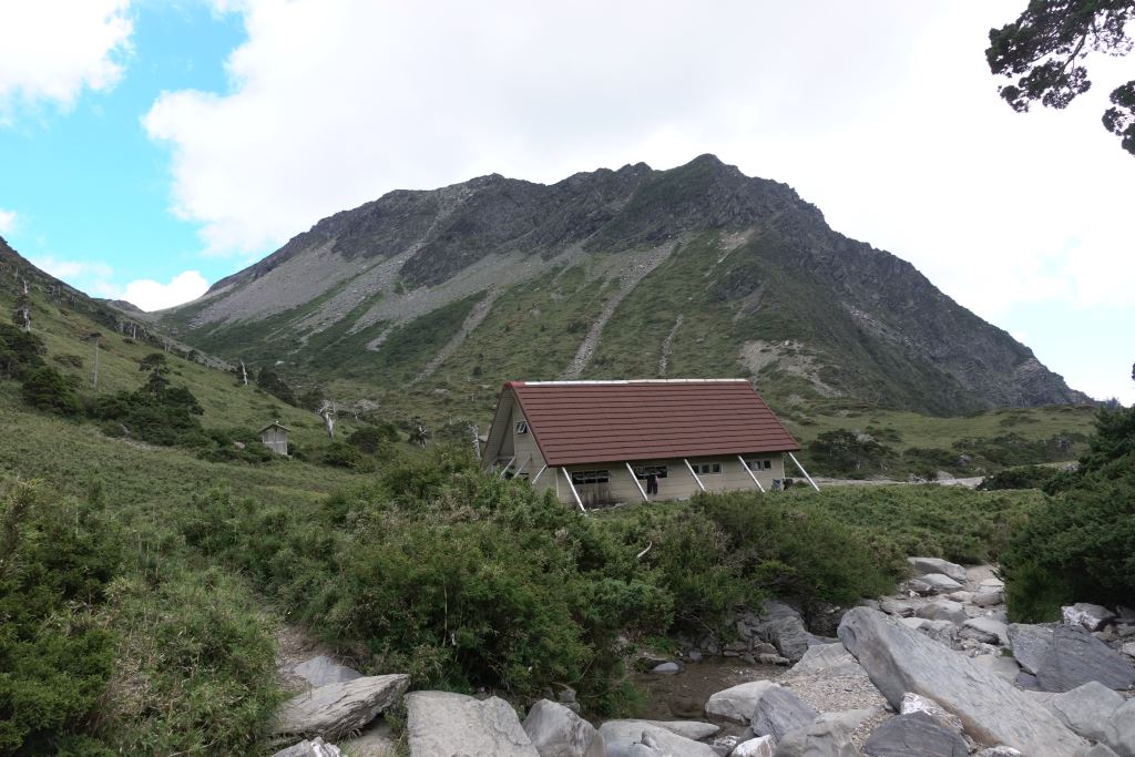
Stop 2: Yunleng Cabin
The rebuilt Yunleng Cabin was completed in 1993 over the course of one year and is 10-15 minutes away from the old cabin site. The framework of Yunleng cabin is constructed out of steel and accommodates 50 persons. The cabin grounds also include a water tower and public toilets. As the water tower has limited storage capacity, please conserve water. If the water tower is dry, water can be sourced at the old Yunleng Cabin site via the nearby stream. The Cabin is equipped with solar-powered LED lighting operated according to the time of day. Please conserve water and electricity, and help contribute to maintaining the cleanliness of Yunleng Cabin.

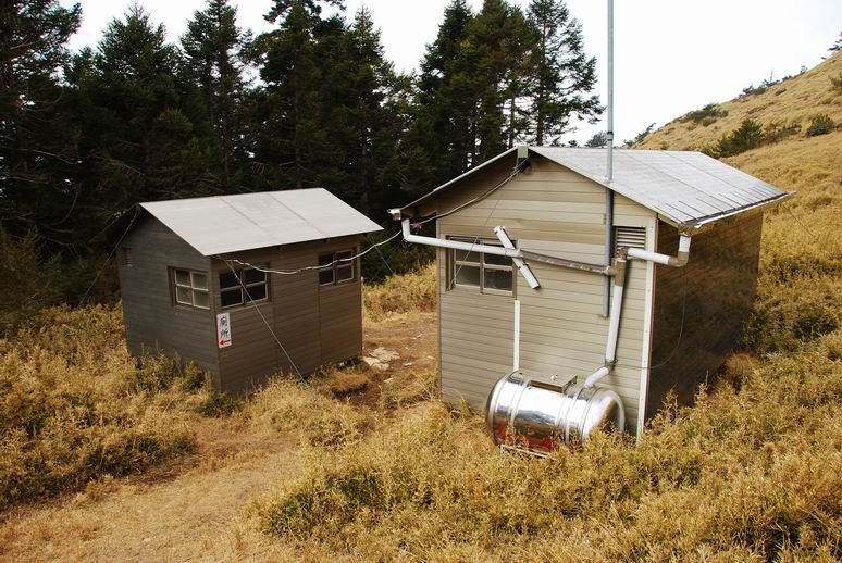
Stop 3: Shenmazhen Cabin
Shenmazhen Cabin is located roughly 25 minutes (1 km) ahead of the junction leading to Mt. Shenmazhen, which, at an elevation of 3141 m, is the first Baiyue along the Nanhu Ridge. Located about 200 m away from the main trail path, Mt. Shenmazhen commands a spectacular view of Mt. Nanhu and Mt. Zhongyangjian.
Shenmazhen Cabin, built in April 1996, is constructed from aluminium sheeting and accommodates 15 persons. The nearby pond holds still water and as such the water quality is poor. However, this pond holds a brilliant reflection of Mt. Nanhu. In addition, a water tower that collects rainwater has been installed at the cabin site. The Cabin is equipped with solar-powered LED lighting operated according to the time of day. Please conserve water and electricity, and help contribute to maintaining the cleanliness of Shenmazhen Cabin.
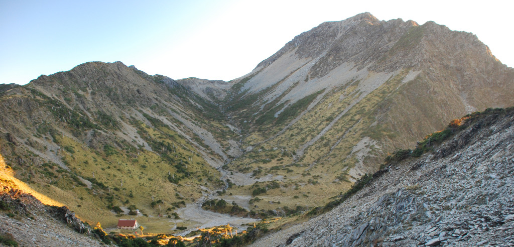
Stop 4: Nanhu Valley Cabin
The Nanhu Valley experienced glacial retreat between 7-10 ka ago, clearly forming the upper and lower valleys. Gardens comprised of high-elevation plants have since flourished in these two areas.
The Nanhu Valley Cabin was officially opened on November 1990, and can accommodate 40 persons. There are two public toilets situated adjacent to the Cabin. Clean (good quality) water can be sourced from the nearby creek. The Cabin is equipped with solar-powered LED lighting operated according to the time of day. When staying at Nanhu Cabin, please conserve electricity and contribute to maintaining the cleanliness of the Cabin.
Resources